Tom Harrison: Mammoth High Country

【旅行】有料アプリランキング
【旅行】総合ランキング
【AppStore総合】有料アプリランキング

旅行
ナビゲーション
2012-03-31
¥360
3.0.0
約189MB
International Mapping
International Mapping
アプリスクリーンショット
アプリ詳細
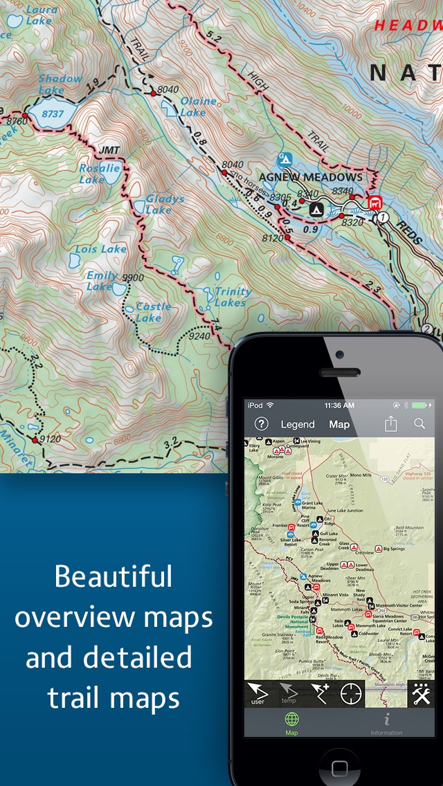
Tom Harrison Maps has produced high-quality California hiking trail maps for a number of years now. To reach a new wave of technologically savvy outdoor enthusiasts, Tom Harrison Maps teamed up with International Mapping to adapt their trail map series for the iPhone and iPad. International Mapping has surrounded their maps with a variety of easy-to-use navigational tools and personal customization features to help make your outdoor experience more enjoyable and memorable.
California’s Mammoth High Country is one of the most popular getaway and outdoor recreation areas in the United States. Planning a hike in the Mammoth High Country? Looking for an app to help you navigate all of the trails? Worried you will not have Wi-Fi access while out on the trail? Then this is the app for you as we have included everything you will need in the download!
Key Content Features:
+ Full content and detail from Tom Harrison’s Mammoth High Country map covering Minarets, June Lake, Ritter Range, Convict Lake, Mono Craters, Devils Postpiles, Mammoth Lakes, Agnew Meadows, and Thousand Island Lake.
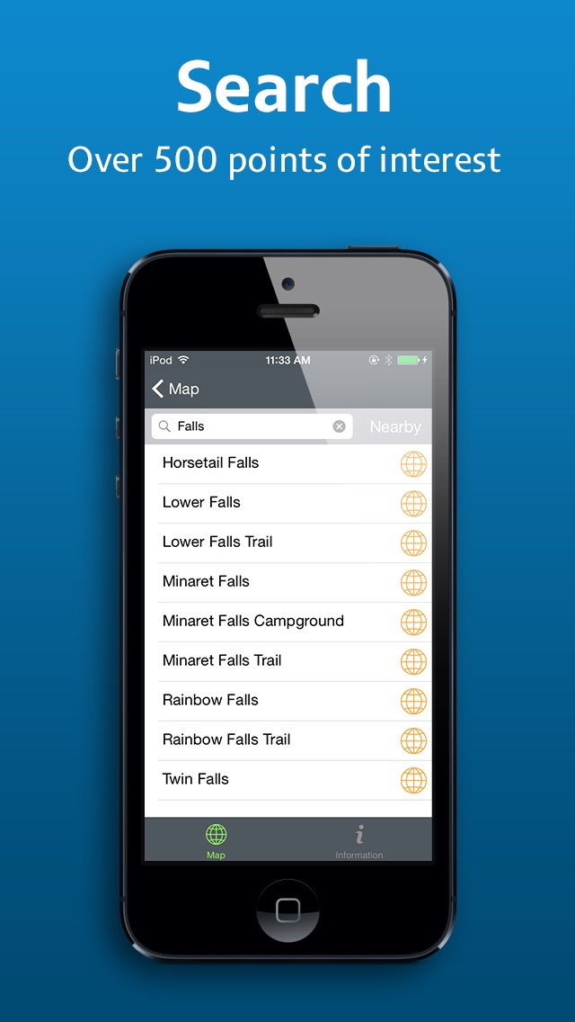
+ Point of Interest listings for over 500 locations in and around the Mammoth High Country Area
Key Features Include:
+ GPS tracking of your location, even without Wi-Fi or cell reception
+ A revolutionary new trail navigation system
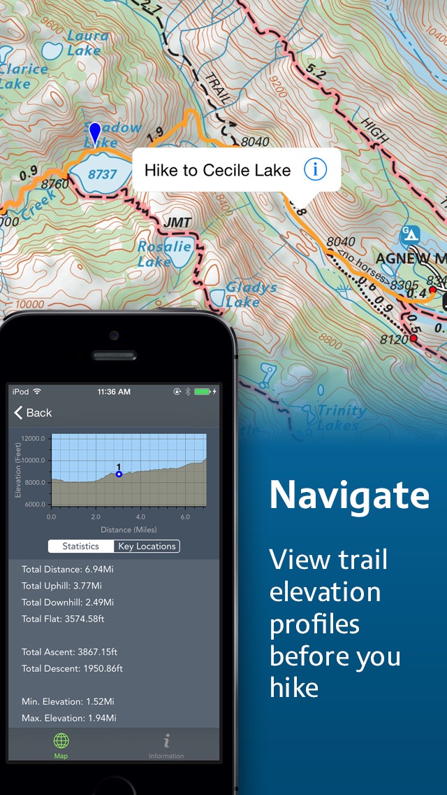
+ Detailed, offline terrain profiling and statistics for any trail you create
+ Map tools including distance, bearing and compass
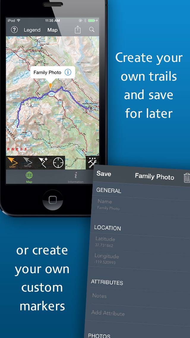
+ Customized pins to record photos, comments, & Locations along your hike
+ Share your custom markers with others who have the app
+ Customize your markers to change their appearance
+ Detailed search capabilities by nearby locations and by type
+ Identify the Latitude/Longitude for any place on the map
Tom Harrison: Mammoth High Country was developed by International Mapping. To learn more visit: www.internationalmapping.com
対応端末
iPad2Wifi-iPad2Wifi / iPad23G-iPad23G / iPhone4S-iPhone4S / iPadThirdGen-iPadThirdGen / iPadThirdGen4G-iPadThirdGen4G / iPhone5-iPhone5 / iPodTouchFifthGen-iPodTouchFifthGen / iPadFourthGen-iPadFourthGen / iPadFourthGen4G-iPadFourthGen4G / iPadMini-iPadMini / iPadMini4G-iPadMini4G / iPhone5c-iPhone5c / iPhone5s-iPhone5s / iPadAir-iPadAir / iPadAirCellular-iPadAirCellular / iPadMiniRetina-iPadMiniRetina / iPadMiniRetinaCellular-iPadMiniRetinaCellular / iPhone6-iPhone6 / iPhone6Plus-iPhone6Plus / iPadAir2-iPadAir2 / iPadAir2Cellular-iPadAir2Cellular / iPadMini3-iPadMini3 / iPadMini3Cellular-iPadMini3Cellular / iPodTouchSixthGen-iPodTouchSixthGen / iPhone6s-iPhone6s / iPhone6sPlus-iPhone6sPlus / iPadMini4-iPadMini4 / iPadMini4Cellular-iPadMini4Cellular / iPadPro-iPadPro / iPadProCellular-iPadProCellular / iPadPro97-iPadPro97 / iPadPro97Cellular-iPadPro97Cellular / iPhoneSE-iPhoneSE / iPhone7-iPhone7 / iPhone7Plus-iPhone7Plus / iPad611-iPad611 / iPad612-iPad612 / iPad71-iPad71 / iPad72-iPad72 / iPad73-iPad73 / iPad74-iPad74 / iPhone8-iPhone8 / iPhone8Plus-iPhone8Plus / iPhoneX-iPhoneX
リリースノート|新機能
WARNING: THIS UPDATE WILL REMOVE ALL CUSTOM PINS AND ASSOCIATED DATA. PLEASE WRITE DOWN THE PIN'S DATA IF YOU WISH TO SAVE IT. **
Introducing the new Tom Harrison: Mammoth High Country App!
We've been hard at work with a complete redesign and overhaul with exciting new features and enhancements to make your experience in Mammoth High Country better. New features include:
+ A sleek, new user interface
+ Retina map tiles for amazing detail on newer devices
+ Much faster tile rendering (as requested!)
+ Save and share user defined paths
+ Re-engineered terrain profile for clarity
+ Find where default and User pinned sites are along the trail in the terrain profile
...and much more!
Please send any feedback using our form: http://internationalmapping.com/mobile-application-support
** In most cases, photos taken in the App are saved to the device's photo gallery. Photos in the device's gallery will not be removed when updating this App. We advise you to make sure you have a copy of the photos outside the App before updating. We apologize for any inconvenience this may cause.


Tom Harrison: Mammoth High Country
ランキング解析情報詳細
【旅行】有料アプリ部門ランキング
2012-03-31
4400日経過
0回/366回
0回/366回
0回/366回
※当データはiOS-App.jpの独自集計によるものとなりAppStoreに実際に表示された内容と若干異なる場合がございます。